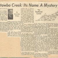
Catawba Creek: Its Name a Mystery
Item
- Title
- Catawba Creek: Its Name a Mystery
- Date
- n. d.
- Description
-
A newspaper article from the serial column "The Southwest Corner," this one about Catawba Creek, which reads,
"Catawba Creek: Its Name a Mystery
Catawba Creek is a stream of distinction.
The name of the stream is distinctive. So far as my knowledge extends no other stream in the United States is named for an Indian tribe that neither lived along its course nor claimed to own any part of it.
The Catawba Indians lived in South Carolina, where they gave their name to a great river that flows through their former home land.
Why their name is also given to a medium size creek in the Southwest Virginia mountains is not known. Some say Iroquois tribes in the north gave it the name because it provided a convenient route for their raids into the Catawba country. Some say that the Shawnees named it because one of their hunting parties by chance met a Catawba hunting party along it and engaged in a battle. Some offer various other explanations. All that is really known for sure about how the creek got it's name is that Indians called it Catawba and white men have been calling it that ever since they found it.
The name has a pleasing sound, and, in addition to the Indian tribe, the river, and the creek, it is given to a scenic and fertile valley that is a very important part of Botetourt County, to a mountain, to a health resort where tubercular patients find relief, to a variety of grapes, and to a popular wine that is made out of the grapes.
A modern dictionary defines the word as "a language of the Siouan family originally spoken in South Carolina," and suggests that it meant "separate" and was adopted by the tribe because it was separated from other members of the tribal family.
The creek is distinctive also because it was a main early travel route to the southwest. For untold generations Indian paths leading in that direction went up to Catawba Creek to its headsprings and over a low divide down head streams of the North Fork of Roanoke River.
The first public road to the Southwest authorized, surveyed, and build by order of a Virginia court went that way. In March of 1745 the Court of Orange County authorized the road and in April Col. Patton and John Buchanan laid out the route, to cross James River where that stream curves around the end of Purgatory, thence up Looney Creek and over the hills to Catawba Valley, then to the steep mountain climb to New River waters, where Blacksburg is now. That became the main road to the Southwest and for years it competed for through traffic with what is now U. S. 11.
The earliest land surveys for English settlements southwest of the James River were made in the valleys of Looney and Catawba creeks and along the river above Buchanan. The earliest recorded were three for Benjamin Borden, all on Catawba Creek. One, made in 1739, was for 8,100 acres. Two, made in 1740, were for 3,553 and 2,880 acres. A survey also was made in 1740 of 319 acres that Borden sold to John McFerran, alleged to have been the first settler on Catawba Creek.
Along with the McFerrans other early settlers on Catawba were James Montgomery and his sons, the Holsteins of Holstons, one of whom was Stephen, who with a canoe party made up in the settlement voyaged down the river that now bears his name, going as far as Natchez, Miss.) and the McAfees, whose name is perpetuated in the region by McAfees Knob. They came to the Catawba in the 1740s and moved to Kentucky in the 1770s, where they made a large contribution towards winning and holding that land.
The McAfees were leaders in the upper part of the Catawba Creek settlement. Some of their land after passing through numerous hands came into possession of the Chapmans who operated on it the Red Sulphur Springs, now Catawba sanitorium.
Late in 1755 or early in 1756 Capt. William Preston built a stout stockade fort at a crossroads along Catawba Creek which was for a time headquarters for his company of rangers in searching the woods for Indians. It was called Ft. William. George Washington inspected it in the fall of 1756.
In the 1760s settlements thickened along Catawba Creek and tragic troubles with Indians increased. In 1769 the first congregation formed southwest of James River was organized near a spring whose water sinks into the ground before it finds its way to Catawba Creek. It was called the Sinking Spring Presbyterian Church, is now housed in a building at Fincastle, and is named for the town.
In 1770 Botetourt County was organized, and its courthouse was located near a mill powered by a small tributary of Catawba Creek." - Creator
- Wilson, Goodridge
- Format
- image/jpg
- Type
- Text
- Publisher
- The Roanoke Times
- Rights
- http://rightsstatements.org/vocab/UND/1.0/
- Item sets
- Community
- Media
 Catawba Creek
Position: 3 (430 views)

